
Tuesday, 29 October 2013
Sunday, 27 October 2013
Spend Any Money Saved On HS2 on SH2: Dual the A303, the A358 and the A30
The Sunday papers are filled with stories of Labour plans to axe the £42 billion HS2 high-speed rail link from London to the North of England in favour of a £6 billion route along the line of the former Great Central Railway closed by Dr Beeching in the mid 1960s. Basically, savings can be made by adopting a route that is still largely undeveloped - affecting far fewer people than the proposed route for the HS2 and requiring less unspoilt countryside to be sacrificed. OK, the size of Labour's predicted saving may be an over-estimate, but money could be saved and the North could get a viable high speed link.

Rumours abound that many Tory and Lib-Dem politicians are also hoping to bail out of the HS2 project, but want to spend any money that is saved on sorting out other transport infrastructure problems in the UK. What could be better than sorting out the main route westward from London - the entire length of the A303, the A358 and the A30? The most sensible way of doing this would be in overcoming the long-standing sticking point that is the Stonehenge World Heritage Site. What we need is SH2, not H2S.
So, there you have it, a possible way to achieve 2 major transport infrastructure goals, allow politicians of all flavours to backtrack on the original HS2 plans without any loss of face, and fund SH2, including a dual carriageway bypass for us here in Winterbourne Stoke, with a few bob left over for some other projects.

SH2
The real engine for growth!
Saturday, 26 October 2013
One Brown Cow Passes Cars on the A303
...well, not quite, but I just got some really useful information from One Brown Cow (@onebrowncow - website onebrowncow.co.uk) on Twitter.

One Brown Cow is a boutique gift shop specialising in quality jewellery, designer and contemporary gifts at 40 High Street, Amesbury, Wiltshire. They are only a stones-throw (more a pebble toss than a trilithon hurl) from the Countess Road roundabout on the A303. Clearly a place you might want to stop off and visit - along with some other smashing shops in Amesbury - when the traffic on the A303 has slowed to a miserable crawl.
One Brown Cow found an open-access Traffic England) Highways Agency traffic camera close to Solstice Park, Amesbury. Take a look here to see the latest view of the A303 at that location.
Further west, there is a similar camera at Mere on the dual-carriageway section there.
In fact, I owe a bit of an apology to the Highways Agency, the Traffic England site is actually pretty good and informative. Go here to find their interactive map. If you want to access the cameras, you will need to click the button next to the camera icon to the right of the map.
UPDATE:
One Brown Cow (@onebrowncow) has just got back to us to say that the Solstice Park camera isn't fixed - at the time of writing, it is now looking back up the A303 towards Beacon Hill and the ever-growing traffic queue.
Friday, 25 October 2013
The Fiction of the Traffic Census - According to the Highways Agency
In an earlier post, we explained how the Department for Transport has a methodology for working out what they call the annual average daily flow (AADF). They seem to rely on a manual traffic census conducted every 2, 4, 6 or 8 years and supplement this with data from Automatic Traffic Counters.
You should read that original article, because it explains why, even if the methodology is used, it is inappropriate for a road like the A303. Anyway, onwards.
We thought it might be helpful, in understanding the traffic flows on the A303, to have an idea of how often manual censuses actually take place, as that says quite a lot about how up-to-date the data being used in the forthcoming reviews might be. So, we fired off an FOIA to the Department for Transport and back came an answer from my new chums at the Highways Agency - charged with managing England's motorways and strategic A-roads on behalf of the DfT - or should that be mismanaging them?

We asked for the details of any traffic censuses on the stretch of the A303 through Winterbourne Stoke since January 2000; very unambiguous and straightforward.

Clearly, these are the manual census categories - yet no manual censuses have been carried out according to HA. Interpolation by witchcraft perhaps? Once again, it seems that the Highways Agency:
A. Couldn't tell their arses from the their elbows - even with the benefit of a map.
B. Are inefficient, ineffectual and can't find their own data.
C. Are being disingenuous.
We have asked for clarification.
We also think the Department for Transport should do a bit of re-branding of the Highways Agency with respect to the A303 - we think this would be a tad more honest:

You should read that original article, because it explains why, even if the methodology is used, it is inappropriate for a road like the A303. Anyway, onwards.
We thought it might be helpful, in understanding the traffic flows on the A303, to have an idea of how often manual censuses actually take place, as that says quite a lot about how up-to-date the data being used in the forthcoming reviews might be. So, we fired off an FOIA to the Department for Transport and back came an answer from my new chums at the Highways Agency - charged with managing England's motorways and strategic A-roads on behalf of the DfT - or should that be mismanaging them?

We asked for the details of any traffic censuses on the stretch of the A303 through Winterbourne Stoke since January 2000; very unambiguous and straightforward.
The reply we got, as with previous FOIA responses from the Highways Agency, took as by surprise. It was the one answer we were definitely not anticipating: "We are unaware of any traffic censuses for the A303"
Wow, not just no traffic censuses on our little bit of the A303 since 2000, but none on any of its 90 mile length during that time period. So, decisions on dualling (or not!) the A303, the closure of the A344, the drawing up of Somerset Council's study on the A303, A358 and A30 have all been based on figures that were not based on manual census data which lies at the heart of the DfT Road Traffic Estimates Methodology. At least that is what DfT claim to do - but seemingly not when it comes to the A303.
Frankly, I think that is pretty disgraceful. I'm sure the HA will protest that they can get all the information they need from the automatic traffic counters (ATC's), but DfTmake it quite clear that the ACTs c.an only collect some of the data recorded in manual censuses that are used to classify vehicle types. The types of traffic are important when considering the A303 and the ACTs. When a manual count is carried out, 6 different classifications of HGV are recognised (3 rigid and 3 articulated). ACTs only recognise HGVs as being rigid or articulated - so they couldn't tell, for instance, the difference between a rigid HGV with two axles and a rigid HGV with four axles.
Which, if DfT/HA are to be believed, makes me wonder how they have come up with traffic statistics like these (click to see enlarged view):

A. Couldn't tell their arses from the their elbows - even with the benefit of a map.
B. Are inefficient, ineffectual and can't find their own data.
C. Are being disingenuous.
We have asked for clarification.
We also think the Department for Transport should do a bit of re-branding of the Highways Agency with respect to the A303 - we think this would be a tad more honest:
Tuesday, 22 October 2013
When Is a Road Not a (Rural) Road?
When is a road not a rural road? Quite simply, when the Highways Agency (HA) have anything to do with it and it suits them.
We mentioned in a previous post that we'd put in a Freedom of Information Act request using the What do They Know website to ask the Highways Agency a fairly simple question - how wide was the A303 as it passed through our village of Winterbourne Stoke.

The reason we asked the question was that at certain points within the village, the A303 looks and feels much narrower than on other parts of the single-carriageway stretches of the road between Beacon Hill and Honiton. We suspected the reason for the narrowness of the A303 in Winterbourne Stoke was the bridge over the River Till, a Grade II listed structure, built in 1939 and pre-dating the creation of the A303 trunk road in 1958.
We'd already made a few measurements of the road ourselves - on the premise of never ask an FOIA unless you already have, or strongly suspect you have, the answer. So whilst we hoped we might get some genuine data, we half-expected we might get a less than satisfactory response - and so it turned out.

Click on the picture to see an enlarged view. Basically, the HA claimed that the A303 is shown in their HAPMS database to be 7.3 metres wide at 20 sites on a 1 mile stretch of the A303 as it runs through the village. This, according to our own measurements, was clearly complete and utter nonsense and it looked as if the HA had simply recorded the minimum desirable width of a an A road as the actual width of the A303. An honest mistake, dodgy instrumentation, incompetence or worse? Well that is for others to establish, but we couldn't let it rest and went back to the HA for further clarification and to point out what we thought was a problem with the data.
The reason that this is so important is that public inquiries, reviews and other studies, rely on the HA to produce accurate data on roads to enable those inquiries to come to informed decisions as to how poor roads might be and how essential it might be to upgrade them. Given incorrect data, they might be led to the wrong decisions. This might have already happened in the past and might happen again in the forthcoming review of the A303.
Yesterday, we received a follow-up answer from the HA and I had to confess that my jaw hit the floor when I saw, shortly before I burst into bouts of uncontrollable laughter. Strangely, others who saw the letter had a similar reaction, making comments such as:
"What (expletive deleted) planet are they on?"
"Does the HA provide LSD for its staff?"
"Have they ever been on the A303?"
What could possibly have provoked such a reaction?

Well, how about the HA statement that the "A303 through Winterbourne Stoke is most suitably referred to as an Urban setting".
I am not quite sure how the HA 'expert' arrived at this conclusion, nor does he explain, but we would have thought that the definition of urban is very clear - it relates to a town or city - not a small village with under 80 dwellings set in a rural parish, in a rural ward of a rural county.
However, to make life very straightforward for the HA and to avoid any possible confusion, we have pointed out that there is an HMG definition of rural and urban. Both the HA and the Department for Transport use this definition in their publications - so you might expect that it would be used in defining whether a road is urban or rural. The UK government define "urban" as outlined below:
"As a standard for general purposes a threshold population of 10,000 is recommended, with
all settlements of over 10,000 treated as urban areas and smaller settlements, together
with all other land, treated as rural".
So, a road in an urban setting would be one that ran through a population centre with a population of 10,000 or more. Hmm, Winterbourne Stoke has just over 200 - hardly an urban setting then. Unless, of course, the HA are counting the people stuck in traffic jams in Winterbourne Stoke as being part of the permanent resident population - well I suppose it does sometimes feel a bit like that.
We've gone back to the HA to ask them to try again and to point out to their expert the difference between rural and urban settings. We've also asked them to clarify where, in their alternate reality, to the east and west of Winterbourne Stoke, does the urban setting of the A303 turn into a rural setting.
This set us thinking a bit. If HA are right and we really are an urban setting, then it is government policy to have speeds of no more than 30 mph through the village because of the houses alongside the road. They would prefer the speed limit should be reduced to 20mph because of the number of properties with entrances onto the A303 in the village (>20- try counting, you'll probably have more than enough time) - along with suitable traffic calming measures - road humps, chicanes, planters, etc. So HA - if you are correct, remove the 40mph sign and lower the speed limit to meet government policy recommendations. Whilst you may not be able to enforce the speed limit, the traffic calming measures would ensure a 24/7 traffic jam that would achieve the effect for you.
Of course, if Winterbourne Stoke is a rural setting, as we strongly suspect it might be, then the A303 is structurally too narrow to be a rural, all-purpose, mainline road road and that gives the HA a bit of a head-ache. What are they going to do? By rights, you'd think they should de-trunk the road.
What is abundantly clear is that the HA can't be allowed have it both ways - and perhaps they should draw the attention of Ministers to their past mistakes to avoid repetition in the coming months.
Finally, you'll note in the HA's second response that the author accepts our road measurement without question. Not only does the author accept it, he re-states it as a matter of fact. A suspicious person might conclude, on the basis of this, that the HA's first answer to us was intended to deceive. Now why might that be?
Monday, 21 October 2013
STAG Come of Age
Well, it seems that STAG - The Shrewton Traffic Action Group - has come of age. Born of the frustration and chaos caused by the closure of the A344 at its junction with the A303 and the remodelling of the junctions at Longbarrow and Airman's Cross to pander to the needs of English Heritage, STAG began with a local focus.
The local focus was quite natural and an attempt to get something done quickly to ease the situation caused by large and sometimes very large vehicles trying to negotiate narrow village streets. In Shrewton's case, this meant squeezing along roads with little or nothing in the way of footpaths, but close to shops, doctor's surgery and school - a recipe for disaster. But the rat running was soon seen to be much wider spread than just Shrewton - affecting villages for miles around the epicentre of Stonehenge.
Moreover, the poor beggars who are using the rat runs really don't want to be using them themselves; they simply want to get from A to B in a reasonable time - and would you be any differnet in similar circumstances elsewher? Of course not. I guess what I'm trying to say is that they are a symptom of the problem and not the root cause. Whilst we can treat the symptoms and ease things in the short term, we aren't going to solve the problem without treating the underlying disease - the Stonehenge World Heritage Site. But both approaches need to be followed.

So STAG has evolved - it has two prongs to its campaign - to ease the situation on the local roads on the one hand, but to campaign at every level for SH2 - dualling and bypasses on the A303.
STAG has become the Stonehenge Traffic Action Group - you can find their new blog here.
The local focus was quite natural and an attempt to get something done quickly to ease the situation caused by large and sometimes very large vehicles trying to negotiate narrow village streets. In Shrewton's case, this meant squeezing along roads with little or nothing in the way of footpaths, but close to shops, doctor's surgery and school - a recipe for disaster. But the rat running was soon seen to be much wider spread than just Shrewton - affecting villages for miles around the epicentre of Stonehenge.
Moreover, the poor beggars who are using the rat runs really don't want to be using them themselves; they simply want to get from A to B in a reasonable time - and would you be any differnet in similar circumstances elsewher? Of course not. I guess what I'm trying to say is that they are a symptom of the problem and not the root cause. Whilst we can treat the symptoms and ease things in the short term, we aren't going to solve the problem without treating the underlying disease - the Stonehenge World Heritage Site. But both approaches need to be followed.
So STAG has evolved - it has two prongs to its campaign - to ease the situation on the local roads on the one hand, but to campaign at every level for SH2 - dualling and bypasses on the A303.
STAG has become the Stonehenge Traffic Action Group - you can find their new blog here.
Sunday, 20 October 2013
The A303 at 1000mph - A Competition!
A free-flowing, fast, A303 "Route to the Sun" is the stuff of dreams for most of us who live alongside the slower sections. I happened across a smashing video that shows the A303 end-to-end in just over 5 minutes. It was shot on a day and at a time when the traffic was relatively light, but even then, there is the standing traffic on the dualled section of the A303 past Amesbury - just before the standing stones. You see similar problems at the start of each of the single carriageway sections as the road travels west. It would have been a much shorter film if we had the SH2!
On a really serious note though, the time spent stuck in traffic from Solstice Park in Amesbury to the Longbarrow Roundabout (before the work was completed and the traffic situation worsened!) took 1minute and 30 seconds of video time, which equals around 25% of the total time for the whole 90 mile journey. Just to cover 4.5 miles of the A303 - 5% of the total distance in 25% of the time for the whole journey!
Think of the frayed tempers, the wasted fuel, the pollution and the added costs of goods that could be avoided by implementing SH2 and dualling the A303, bypassing Winterbourne Stoke and the other afflicted villages along its length. This was only a moderately busy day, not a very busy one. Imagine the waste that occurs day after day at the peak times of year!
Then take a look at a section of the BBC film of A303 Highway to the Sun as it passes through our village of Winterbourne Stoke. This shows just how difficult simply getting out on to the A303 can be for our local farmer, Rob Turner - and that is for someone driving a large 4 x 4, or even a farm vehicle which is very hard to ignore (and sadly, some folks do try). Imagine how much harder it is for someone in a small car, a motorcyclist, or, god forbid, a cyclist to get out onto the A303 safely.

COMPETITION
We enjoyed the A303 at 1000mph so much, we thought we'd turn it into a competition - and we have a bottle of bubbly on offer to the winner. The rules are very simple. All you have to do is repeat the the journey along the whole 90 mile length of the A303 and record it on video. Submit the video to YouTube and send us the link using the Contact Form at the foot of the page.
1. The winning video will have the highest percentage of the overall journey time stuck in traffic between the Countess Roundabout at Amesbury and the junction with the A36 at Wylye.
2. Journeys can be recorded West to East or East to West.
3. We do not condone breaking any traffic laws in pursuit of the prize.
4. Our decision as to the winner is final!
5. The winner will be announced on 1st January 2014 - or as soon afterwards as we can manage!
If you know your attempt at glory has failed but happen to record something of particular interest to our campaign, caused by the poor quality of the A303, then let us see it anyway, their may be additional spot prizes for interesting stuff - if we can find a few sponsors amongst the business community along the A303 corridor.
If you want to get involved by sponsoring a competition, then we would love to hear from you also!
UPDATE To The Competition - By Popular Demand.
A second bottle of bubbly is on offer for the slowest video-recorded journey between the Countess Roundabout in Amesbury and the Wylye interchange with the A36 - no need to record a trip along the entire A303.
Rules 2, 3, 4 and 5 above also apply.
You might be very lucky and win both bottles!
A second bottle of bubbly is on offer for the slowest video-recorded journey between the Countess Roundabout in Amesbury and the Wylye interchange with the A36 - no need to record a trip along the entire A303.
Rules 2, 3, 4 and 5 above also apply.
You might be very lucky and win both bottles!
Saturday, 19 October 2013
SH2 Not HS2 - A Real Engine for Growth
If you have been affected by traffic chaos in and around the Stonehenge area, which has been massively increased by the expensive vanity project that is the new visitor's centre and the closure of the A344, please sign the Stonehenge Traffic Action Group's petition.

We need a step-change from more than 30 years of so-called consultation by dithering and duplicitous local and national government bodies. Poorly planned though it is, the opening of the new Stonehenge visitors' centre on 18th December 2013 provides a rare and truly global platform to embarrass them into action.
And when I say 'us' I mean ALL those who live, work or travel along the full length of the A303; a key national and international arterial road with socio-economic implications in Westminster, Brussels and beyond.
To dual the Stonehenge section of the A303 is the only viable solution – an objective that STAG and WiSBAng call "SH2."
So, politicians, here's a chance to bow down gracefully from HS2 and make a real difference by spending a fraction of that money on SH2 and be a real engine of growth for West Country businesses.

Act now on SH2 (Stonehenge Dualling) and get rid of the jam today!

We need a step-change from more than 30 years of so-called consultation by dithering and duplicitous local and national government bodies. Poorly planned though it is, the opening of the new Stonehenge visitors' centre on 18th December 2013 provides a rare and truly global platform to embarrass them into action.
And when I say 'us' I mean ALL those who live, work or travel along the full length of the A303; a key national and international arterial road with socio-economic implications in Westminster, Brussels and beyond.
To dual the Stonehenge section of the A303 is the only viable solution – an objective that STAG and WiSBAng call "SH2."
So, politicians, here's a chance to bow down gracefully from HS2 and make a real difference by spending a fraction of that money on SH2 and be a real engine of growth for West Country businesses.

HS2 is unproven - jam tomorrow?
Act now on SH2 (Stonehenge Dualling) and get rid of the jam today!
Friday, 18 October 2013
A Council of War: A Meeting of Minds
Another Friday and the traffic build-up on the A303 continues. In some ways, this was like every Friday, but in other ways, this was very different. We held a war council in Shrewton. This seems set to be the first of many and, as interest grows, more and more villages will be represented and welcomed into the fold.
You'd think that in this day and age, face-to-face meetings were unnecessary and could be facilitated by technology, but one of the other nasty little secrets of the A303 is that whilst some of the UK's biggest and most important broadband trunks run under it - from London to Cornwall and then off across the Atlantic - the villages that straddle the A303 have some of the worst broadband connectivity in the country.

On the plus side, we have a great sense of community here in rural Wiltshire and whilst villages each have their own identity, they are also actively linked to other local villages in a sort of mutual support network. Usually, it doesn't extend much beyond church, fete, pub, etc; unless something crops up to grab our common attention - and the A303, the worsening problems created by the closure of the A344, the idiotic roundabout designs at Longbarrow on the A303 and Airman's Cross by the new Stonehenge visitor centre, has done just that; bringing us closer together in the process.
Earlier this evening, despite lots of earlier email and telephone contacts, a bunch of us met up for something of a war council - representatives of STAG and WiSBAng, local and regional politicos, some folks with media and publicity backgrounds, local business people, long-distance commuters, information scientists, others with some fairly arcane skills that will become very apparent in the weeks and months to come. The most striking thing was that this was a meeting of minds, everyone willing to listen and every suggestion given an equal hearing. There was a willingness to take on tasks and an offering of skills that I have rarely seen before. This campaign is gaining legs.
We have an engagement plan for the next few weeks that will start to address the breadth of this issue - from the local villages, the problem that is the Stonehenge World Heritage Site, the insensitivity of English Heritage to local needs through to the national and international requirements for rapid, safe and green travel across the UK.
Support for this campaign is growing, not only locally and in the obvious constituency of the A303 corridor, but from all parts of the United Kingdom and beyond, into Europe.
Whether you live in the shadow of Stonehenge, elsewhere in Wiltshire, further West in Somerset and Devon, anywhere else in the UK and Europe or beyond and you want to help, we want to hear from you.
If you want to get involved, we would ask you to do two things. First, leave a message for us using the Contact Form at the very foot of this page - just below our FREE ROCKERY offer! We will get back to you to find out what skills you have to add, what doors you can open and what leverage you can apply.

Second, please could you pop across to the STAG site and sign the petition.
You'd think that in this day and age, face-to-face meetings were unnecessary and could be facilitated by technology, but one of the other nasty little secrets of the A303 is that whilst some of the UK's biggest and most important broadband trunks run under it - from London to Cornwall and then off across the Atlantic - the villages that straddle the A303 have some of the worst broadband connectivity in the country.

On the plus side, we have a great sense of community here in rural Wiltshire and whilst villages each have their own identity, they are also actively linked to other local villages in a sort of mutual support network. Usually, it doesn't extend much beyond church, fete, pub, etc; unless something crops up to grab our common attention - and the A303, the worsening problems created by the closure of the A344, the idiotic roundabout designs at Longbarrow on the A303 and Airman's Cross by the new Stonehenge visitor centre, has done just that; bringing us closer together in the process.
Earlier this evening, despite lots of earlier email and telephone contacts, a bunch of us met up for something of a war council - representatives of STAG and WiSBAng, local and regional politicos, some folks with media and publicity backgrounds, local business people, long-distance commuters, information scientists, others with some fairly arcane skills that will become very apparent in the weeks and months to come. The most striking thing was that this was a meeting of minds, everyone willing to listen and every suggestion given an equal hearing. There was a willingness to take on tasks and an offering of skills that I have rarely seen before. This campaign is gaining legs.
We have an engagement plan for the next few weeks that will start to address the breadth of this issue - from the local villages, the problem that is the Stonehenge World Heritage Site, the insensitivity of English Heritage to local needs through to the national and international requirements for rapid, safe and green travel across the UK.
Support for this campaign is growing, not only locally and in the obvious constituency of the A303 corridor, but from all parts of the United Kingdom and beyond, into Europe.
Whether you live in the shadow of Stonehenge, elsewhere in Wiltshire, further West in Somerset and Devon, anywhere else in the UK and Europe or beyond and you want to help, we want to hear from you.
If you want to get involved, we would ask you to do two things. First, leave a message for us using the Contact Form at the very foot of this page - just below our FREE ROCKERY offer! We will get back to you to find out what skills you have to add, what doors you can open and what leverage you can apply.
Second, please could you pop across to the STAG site and sign the petition.
Tuesday, 15 October 2013
Are English Heritage Being Economical with the Truth, Being Unhelpful or Simply Being Ineffectual?
We've just had a response to an FOIA from the Historic Buildings and Monuments Commission for England - otherwise known as English Heritage. We'd used the What Do They Know Site for simplicity and also to enable others to search both the question and the response.

We had asked a fairly straightforward question and that was, how many vehicles have been using the Stonehenge car parks over the last few years. Clearly, in planning car-park sizes and access requirements for the new visitor's centre, you would have though English Heritage might have had to come up with a few facts and figures to support their planning application, facts and figures that would be required by the relevant planning authorities, facts and figures that could be checked and validated.
Well, you might think they would have such facts and figures, but apparently not. Their answer to the FOIA was:
"Having considered your request I can confirm that English Heritage does not hold the information that you have asked for."
That took us by surprise. If English Heritage really don't have such information, then the car-park for the new visitor's centre had been built without any evidence to support its size, cost and location - which raises lots of questions about competence, damage to virgin countryside, etc etc. It raises similar concerns about the relevant planning authorities.
Alternatively, English Heritage may be being deliberately obstructive or economical with the truth. We had asked for a breakdown of data on the basis of vehicle type, as used by the Department for Transport, on the assumption that English Heritage (an executive Non-Departmental Public Body sponsored by the Department for Culture, Media and Sport) might be expected to collect data to a common standard with government departments and other public bodies. Perhaps they don't and collect data in some other form which doesn't directly equate to such common standards - in an ineffectual sort of way.
If they were collecting any sort of traffic data for the Stonhenge site, you might have expected them to volunteer that fact if the question was clearly intended to elicit such information - but they haven't done that. So if they have any relevant data, they are being unhelpful and disingenuous. Similarly, if they have used or had access to such data prepared by others, you would expect them to indicate who that might be.
Of course, there may be other explanations and so, before pointing fingers, we have requested an internal review of the answer - as we are prepared to be charitable and accept that English Heritage are merely being ineffectual for the moment.
However, until such clarification is forthcoming, we have to accept English Heritage's own explanation that they "do not hold the information that you have asked for", meaning the new visitor's centre at Stonehenge has been built without any idea of the vehicular traffic likely to use it; suggesting that English Heritage have ridden roughshod through the planning process. It makes you wonder if a similar lack of stratification of traffic using the A344 was used to defend the decision to close it at the behest of English Heritage?
UPDATE:
A very swift response from Historic Buildings and Monuments Commission for England
"Having read your most recent email you would appear to asking for different information to that which you did initially: your most recent request focuses on the general use of the car park at Stonehenge while the latter was concerned with the use of the car park by specific types of vehicles.
Given the above I do not think that an internal review is appropriate. Instead your most recent query l will be treated as a new request."
I have to say it smacks of unhelpful games being played...
...I think there was a lack of candour in the original answer.
Saturday, 12 October 2013
John Glen MP
Yesterday evening I had a very interesting e-mail exchange with John Glen MP regarding his views of the traffic issues in the villages around Stonehenge following the closure of the A344, the changes to the Airman's Cross junction and the "improvements" to the Longbarrow roundabout, as well as the more general issue of the need to dual the A303 along its entire length.
I wanted to elicit John's views for two reasons. First, I had sensed a perception, rightly or wrongly, in some quarters that, in relation to the A303, John was not being as supportive to his constituents as he might have been. Second, I wanted to get the views of politicians of all hues at local, regional, national and international level, on this issue and have, or will be extending the offer of space on the blog to make their views known.
John very kindly provided the text below - I've highlighted a couple of points that have particular resonance here at WiSBAng and would like to see feedback from readers:

The Stonehenge Traffic Action Group STAG campaign gains momentum and I would welcome the opportunity to set out my views to move forward the case for improvements to our congested local roads.
I toured the long-standing and new bottlenecks around Stonehenge with a member of Amesbury Town Council two weeks ago, met with STAG and a number of and parish council members in Shrewton on 29th September and travelled to County Hall to put the case to the most senior Highways Officer in Wiltshire.
I also raised the matter in Parliament on 10th October 2013 at Business questions.
John Glen (Salisbury) (Con):
The closure of the A344 alongside Stonehenge appears to have caused chaos along the A303. The Stonehenge traffic action group is very keen for the roads Minister to make a statement on progress made towards dualling this infamous stretch of road. Will the Leader of the House ensure that that happens?
Mr Lansley:
I completely understand my hon. Friend’s point. I sat in a queue on the A303 in August, so I had the benefit of that experience myself. I will, of course, ask my colleagues at the Department for Transport about this. As my hon. Friend and the House knows, the Department is well aware of the problem and is seeking to deal with it. I hope that, by the end of the year, it will be in a position to make announcements as a result of its study of the relevant options.
I have also secured agreement for the Minister to visit and was interviewed on Wiltshire Radio about it on 5th October and will be on Spire FM in coming days.
There are clearly immediate issues around signage near Stonehenge that the council has agreed to look into; for example, the current roadside signs directly conflict with sat nav directions, causing a great many tourists to shuttle back and forth between Countess and Longbarrow roundabouts quite needlessly
I think that making the Stonehenge signage far clearer to give first time visitors the confidence to ignore their sat navs will make worthwhile difference and is something that can hopefully now be done fairly quickly. All possible routes to the stones need to be examined to see whether they are optimally signposted.
The bigger issue of the capacity of the A303 is another matter and does not fall under the jurisdiction of the local authority but is a national infrastructure project that is under the spotlight at the moment, with Ministers talking of capital spending once again as part of a series of upgrades to key routes around the country.
The shift from single to dual carriageways causes a great many problems along the entire length of the road and my challenge will be to go ensure that Wiltshire’s case is heard as clearly as that of Somerset’s representatives and ensure that any improvements cover the area around Stonehenge before they get into Somerset.
Dualling or tunnelling under the A303 past Stonehenge has been mooted before and government funding was made available before but that the project finally bit the dust after years mired in costly public enquiries and legal challenges from environmentalists, conservationists and archaeologists.
Much as I place the practical needs of the communities along the A303 first and foremost, I have to accept the political reality that the stretch of the road in my constituency runs through a UNESCO World Heritage Site and therefore any road widening here will be subject to far more international scrutiny and greater likelihood of legal challenge than almost anywhere else.
Furthermore when the costs of ameliorating these concerns are fully set out the case for justifying the expenditure when set against other deserving road improvement schemes elsewhere in the country is an even tougher one to make.
Nevertheless, it is clear to me that our need for improved traffic flow, howsoever achieved, is every bit as urgent as other areas and I plan to make the case as strongly as I can that no money must be spent on the ‘easy’ projects further west until the Stonehenge road issue is resolved. After all, no-one can get there from the east without passing through our overstretched portion of the A303. Repetitious “feasibility” studies which wastefully go over old ground must also be avoided.
To that end, I am pleased to say that, the roads minister has agreed to meet with campaigners from this area – a meeting which I hope will help to convey the strength of locals’ concerns.
I would love to be in a position to deliver a quick and easy solution but, in all honesty, a complex debate lies ahead – one in which my personal views will compete alongside many other concerns – some of which do not share the same assessment of what will be the best solution.
However, I can assure you it is a battle that I am very much ready for and I am engaged in.
Clearly, John has not been sitting on his laurels and has already achieved quite a bit and has more in the pipeline, or planned.
We must now make sure that the opportunity he has created for us to engage with the road minister is fully taken advantage of and that all the interest groups and Parish Councils, etc., from all the villages concerned, are involved in this meeting.
Friday, 11 October 2013
Yet Another Damn Feasibility Study and Another Delay!
Roads minister Robert Goodwill today announced yet another dualling feasibility study for the A303. This is expected to be complete by spring 2015 along with other key roads.
You have to ask yourself just how many feasibility studies are needed for a government of any persuasion to get the message that something needs to be done quickly. Another long delay is completely unacceptable.

Methinks goodwill is going to be the last thing offered to the roads minister from this neck of the woods. We've posted his picture so you will recognise him if you see him stuck in an A303 jam. If you do spot him here, there or anywhere, please have a word and help him to see the error of his ways!
UPDATE: I am sure that it is an absolute co-incidence that the next election is due to take place on Thursday 7th May 2015. Anyone care to give odds on the reporting date for the feasibility study being Friday 8th May 2015, or later?
Thursday, 10 October 2013
STAG Begins to Lock Horns
It seems that slowly, but surely, the Shrewton Traffic Action Group (STAG) is gaining traction. In doing so, the Press are beginning to take an interest and that is beginning to get officialdom taking things a little more seriously than they have so far. They'd better - this is only the beginning.

Both last week and this week, there was some excellent publicity in the Salisbury Journal in relation to the STAG petition and taking it to 10 Downing Street. This morning, STAG were interviewed by Spire FM and it seems that English Heritage want an informal chat with STAG tomorrow...

...now that will be interesting. Will it be to offer support for a plan to re-open the A344? Support for a "cut and shut" two-level dual carriageway past the stones on the route of the original A303 maybe? To deliver news that Stonehenge has been sold to the Disney Corporation and is being shipped to a more suitable site in the Nevada Desert perhaps. Or is it just to express their concern that attention is being drawn to the Free Local Residents Passes?
After all, if each of the 30,000 adults in the local area who seem to be eligible for the passes take up the scheme and each takes just one child to visit Stonehenge, just once a year, then this would add 60,000 visitors to the Stonhenge annual visitor statistics. Put another way, that is a minimum of £384,000 in lost revenues. If each local visit were to involve 2 adults accompanying 6 children, then the loss could be nearly £700,000 per annum. Stonehenge gets around 900,000 visitors a year - so if these locals visited Stonehenge just once a year it would represent around 13% of the annual visitors to Stonehenge. Ouch! If they visit once a month, they will be in the majority and represent a 2-year potential loss of revenue to English Heritage of £16.8 million.
Whatever English Heritage claim to be their motivation to meet with STAG, you might guess that numbers like these would be influencing their thinking - at least a little.
Monday, 7 October 2013
The High Points and Low Points of the A303
A few miles west of Andover, travellers along the A303 cross from Hampshire into Wiltshire and shortly thereafter encounter Beacon Hill; with Boscome Down and Porton Down visible to the south and Bulford over the crest of the hill to the north.
At the summit of Beacon Hill, at a height of around 560ft above sea level, is perhaps one of the most important points on the entire length of the A303. Obviously, it's a high point because it is at the highest point of Beacon Hill. But the reason it's a low point is much less obvious.

Can you think what it might be? Why do we regard it as a low point? Need a clue?
OK, take a look here then:

Can you see it now? Look in the foreground to the left of the carriageway. Can you see how the strip of tarmac immediately to the left of the continuous white line all but disappears? The similar strip on the right hand side of the carriageway continues for a few metres further, to roughly a point level with the back of the car transporter ahead of the Google Earth camera car.
So what? We would argue that this point is where the A303 changes from being a high quality trunk road with carriageways wide enough to take modern traffic, to the narrow roads that lead beyond, past Stonehenge, to Winterbourne Stoke.
 Apart from a few (but, not all) of the more modern dual carriageway sections and the 3-lane "death trap" sections, that little strip of tarmac never re-appears between the top of Beacon Hill and Penzance. It never ever appears on an un-dualled section of the A303. It represents the effective loss of 1.2 metres off the overall width of a single carriageway road, or 2.4 metres off the width of a dual carriageway. That little strip of land, that inocuous-seeming piece of tarmac at the edge of each lane might represent the difference between life and death for a pedestrian, a cyclist or a motor-cyclist. That's how important it is! Life and death important.
According to the Department for Transport in its Design Manual for Roads and Bridges (2005), the specifications for rural dual and single carriageway roads are as shown below (click on the picture to get a larger view).

So East of Beacon Hill, by and large, the A303 complies with this, but West of Beacon Hill, all the way south west through Somerset and into Devon, down to the junction with the A30, it largely doesn't. The consequences of this are fairly damning - west of Beacon Hill, the A303 is largely not fit for purpose, it certainly isn't fit to be a trunk road. It isn't really fit to be an un-trunked A-road. All this assumes that the lanes of the A303 (the bit between the centreline of the carriageway and the outermost edge of the edge line are 3.65 metres in width. We should never take anything for granted and the width of these lanes is something we will return to later.
I'm sure that someone somewhere will take delight in pointing out that these are modern standards and that you can't expect an old road to match such a standard. To an extent a fair argument, particularly for a road that had followed its current course for a century or more. But as we saw in earlier posts, that doesn't really apply to the A303 and the stretch between Amesbury and Mere, through Winterbourne Stoke, in particular. The A303 only came into being in 1958 - fairly recently in the great scheme of things.
Perhaps the most embarrassing point is that shown in the first photograph. Someone, somewhere decided to make the A303 metalled surface 2.4 metres narrower to the west of Beacon Hill summit than it was to the east. Now just which half-wit, or half-wits, were responsible for that piece of forward thinking? Perhaps it is time to de-trunk the A303!
At the summit of Beacon Hill, at a height of around 560ft above sea level, is perhaps one of the most important points on the entire length of the A303. Obviously, it's a high point because it is at the highest point of Beacon Hill. But the reason it's a low point is much less obvious.

Can you think what it might be? Why do we regard it as a low point? Need a clue?
OK, take a look here then:

Can you see it now? Look in the foreground to the left of the carriageway. Can you see how the strip of tarmac immediately to the left of the continuous white line all but disappears? The similar strip on the right hand side of the carriageway continues for a few metres further, to roughly a point level with the back of the car transporter ahead of the Google Earth camera car.
So what? We would argue that this point is where the A303 changes from being a high quality trunk road with carriageways wide enough to take modern traffic, to the narrow roads that lead beyond, past Stonehenge, to Winterbourne Stoke.

According to the Department for Transport in its Design Manual for Roads and Bridges (2005), the specifications for rural dual and single carriageway roads are as shown below (click on the picture to get a larger view).

So East of Beacon Hill, by and large, the A303 complies with this, but West of Beacon Hill, all the way south west through Somerset and into Devon, down to the junction with the A30, it largely doesn't. The consequences of this are fairly damning - west of Beacon Hill, the A303 is largely not fit for purpose, it certainly isn't fit to be a trunk road. It isn't really fit to be an un-trunked A-road. All this assumes that the lanes of the A303 (the bit between the centreline of the carriageway and the outermost edge of the edge line are 3.65 metres in width. We should never take anything for granted and the width of these lanes is something we will return to later.
I'm sure that someone somewhere will take delight in pointing out that these are modern standards and that you can't expect an old road to match such a standard. To an extent a fair argument, particularly for a road that had followed its current course for a century or more. But as we saw in earlier posts, that doesn't really apply to the A303 and the stretch between Amesbury and Mere, through Winterbourne Stoke, in particular. The A303 only came into being in 1958 - fairly recently in the great scheme of things.
Perhaps the most embarrassing point is that shown in the first photograph. Someone, somewhere decided to make the A303 metalled surface 2.4 metres narrower to the west of Beacon Hill summit than it was to the east. Now just which half-wit, or half-wits, were responsible for that piece of forward thinking? Perhaps it is time to de-trunk the A303!
Saturday, 5 October 2013
Good Information is Essential to Make Our Case
One of the difficulties in pressing forward the argument for a bypass for Winterbourne Stoke and Stonehenge is that we need good information to inform our position and to rebut the arguments of the opposition. Often, the information we need is deeply buried and seemingly inaccessible and is often under the control of the very people and organisations who are proving a stumbling block.
Part of the mission of this blog is to wheedle out that information, provide easy links to it so that you can read it for yourselves, but also to consider whether the data that is being used is valid. Just because information comes from an official source doesn't mean it is credible, doesn't mean it makes the case that is claimed and sometimes it has been (let's be charitable here) mis-interpreted by the opposition. It is for you to make up your own minds whether that misinterpretation is accidental or wilful.
Links to this information will appear both in the text of related blog posts, but also under the "Favourite A303 Links" section to the right of the blog posts. Although the blog has an easy search facility, we wanted all the useful stuff in one place to save time.

Of course, not all of the information from official sources is readily available. However, we can make use of the Freedom of Information Act (FOIA) to try and get at much of that. It is very easy to do and essentially means you just write to the official body you think controls the information and ask them for it. In simple terms, if the information you have asked for is not exempt from the FOIA (eg it's a national security issue), it isn't going to cost too much and take too long to answer it (disproportionate cost to the public interest value) and isn't covered by any other statutory "get out" clauses, then the information owner is legally obliged to provide the answer within a very short space of time. If they don't, the whole issue can be escalated to the Information Commissioner for review. The good news is that much of the information these days is held in searchable, electronic databases (and more historical data is digitised daily), so rejecting an FOIA on the grounds of cost is becoming increasingly indefensible. The best FOIA questions are those where you may already know, or strongly suspect, what the answer is, but want original documents or hard facts and figures to reference in making your case.

The whole FOIA process is made so much easier if you use the What Do They Know? website. This is a smashing resource that gives you advice on how best to formulate an FOIA request, sends it off to the appropriate authority on your behalf, tracks progress and warns you if the recipient is failing to respond in time. It provides an easy way of commenting on a response and then asking supplementary questions. However, the biggest advantage is that the whole process is public. If you make an FOIA request on your own, only you get the answer, it isn't public, isn't searchable and so isn't as useful to others.
In a campaign like this one, getting the information into the public domain is vital; so if you are tempted to make an FOIA request, please use What Do They Know.
So, what information is there already. Well, there are already links to the Trunk Road Act (1936) and the later amendment to it, the Trunk Road Act (1946). All good historical scene setting on trunk roads. If you like the minutiae of Acts of Parliament, they may be of interest to you.
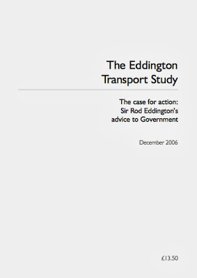
There are two excellent recent documents that everyone involved in this campaign should read and refer to. The first is "The Eddington Transport Study" of December 2006 - written for the British Government by the Australian former CEO of BA, Sir Rod Eddington
The Eddington Transport Study set out the case for action to improve road and rail networks, as a "crucial enabler of sustained productivity and competitiveness". The report's main conclusions were that Britain has transport networks that provide the right connections, in the right places, to support the journeys that matter to economic performance. But roads in particular were in serious danger of becoming so congested, the economy would suffer. Something most of us would agree with.
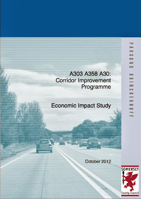
The second document, and by far and away the single most important information source we have come across, so far, is the "A303, A358, A30: Corridor Improvement Programme - Economic Impact Study" of October 2012. This most boring sounding report was produced by Parsons Brinckerhoff for Somerset County Council. What on earth has a report commissioned for Somerset County Council got to do with the little village of Winterbourne Stoke in Wiltshire, rat-running on the roads around and the problems at Stonehenge?
Well you might ask. Somerset Council are to be congratulated for an inspired piece of work. Parsons Brinckerhoff undertook an appraisal of the economic benefits of dualling the full length of the A303 between Amesbury and Honiton as well as the A358 between Ilminster and Taunton. The bottom line, for all of us, is that if the A303 and the A3588 were both dualled, then in the context of this plan as a whole, for every pound spent on providing an A303 by-pass for our village of Winterbourne Stoke, the economy would recover £1.80. For every pound spent putting the A303 in a tunnel the economy would recover £1.80. The economic advantage is astonishing. Isn't it a crying shame that Wiltshire Council hadn't either participated fully with Somerset Council and produced a joint document with breakdowns to county level or commissioned a purely Wiltshire-centric study at any point over the last 30 years?
Despite the horrific title, this report is a really good read - and we suggest everyone does at least dip into it. It is full of useful facts and figures that we can make use of in the campaigns to improve our lot. It is also very well researched and the authors have, in places demonstrated they have seen through the inadequacies of some of the Government's own data processing and interpretation. Perhaps the best example of this is when it comes to traffic volumes.
Consider the traffic statistics for our village of Winterbourne Stoke. They look fairly interesting, but one set of numbers got me thinking - those for bicycles. It seems that four times more bikes go west through our village than go east. There could be lots of reasons for this, but amongst the most likely reasons is the fact that it may simply be an aretfact of the way data was collected. Thankfully, the Department of Transport has published its methodology for Road Traffic Estimates.
More turgid stuff, but what it appears to say is that they try to do a manual count on each sampled road length, like the census point 6874 on the A303 at Winterbourne Stoke, as often as they can. In reality, this means that every 1, 2, 4 or 8 years (depends on the road), they conduct a manual survey for 12 hours. Of course, they don't work weekends, public holidays or school holidays; nor do they survey between November and February. They only undertake manual counts on the 110 what they call 'neutral days' each year. I guess that is DoT speak for saying they only work on Tuesdays, Wednesdays and Thursdays when it isn't cold - poor dears!
These infrequent manual counts are supplemented by electronic input from a national network of 180 (yes, you read that correctly 180) of Automatic Traffic Counters that are used to produce what they call "expansion factors" to interpolate the traffic flow 24 hours a day, 365 days a year; something DoT refer to as the annual average daily flow (AADF). In other words, this is pseudo-science, a wise-arse guess, or more succinctly, in the vernacular, complete and utter bollocks.
Interpolating from data derived in this way has a number of effects. Regardless of any seasonal road traffic variations, the inbuilt methodological bias will overestimate the AADF on urban roads where traffic flow is predominantly on weekdays and underestimate traffic flow on rural roads. The methodology will grossly underestimate traffic flow on the A303 and similar rural trunk routes to holiday destinations, where high traffic flows are predominantly over the weekend, bank holiday and school holiday periods when the manual data is simply not collected.
Worse is to come. Investment in roads inevitably follows the perceived usage 'statistics'. When the usage statistics are as flawed or fictitious as the AADF, the money will be used for urban roads and not rural ones. It's all down to perception management - we have to ensure the debate questions and asks for validation of every bit of data that is presented - regardless of the source.

Parsons Brinckerhoff, in undertaking the "A303, A358, A30: Corridor Improvement Programme - Economic Impact Study" appear to have looked at the DoT methodology and found it wanting. They seem to have come up with a different, possibly more robust approach to traffic flow (see section 2.2 of the above report), but it is still based on the manual and automated traffic counts. We'll be doing some more digging to see just how robust this approach really is.
We suspect that the report may still underestimate traffic flows on the A303, but the good news to end this post on, is simply this. Parsons Brinckerhoff may also have have underestimated the financial benefit to cost ratio of dualling the A303 and thus providing a bypass to Winterbourne Stoke. That is even without considering both the financial and non-financial benefits to Shrewton, Orcheston, Tilshead, Larkhill, Durrington, Berwick St James, Stapleford and all the other local villages currently suffering
Part of the mission of this blog is to wheedle out that information, provide easy links to it so that you can read it for yourselves, but also to consider whether the data that is being used is valid. Just because information comes from an official source doesn't mean it is credible, doesn't mean it makes the case that is claimed and sometimes it has been (let's be charitable here) mis-interpreted by the opposition. It is for you to make up your own minds whether that misinterpretation is accidental or wilful.
Links to this information will appear both in the text of related blog posts, but also under the "Favourite A303 Links" section to the right of the blog posts. Although the blog has an easy search facility, we wanted all the useful stuff in one place to save time.

Of course, not all of the information from official sources is readily available. However, we can make use of the Freedom of Information Act (FOIA) to try and get at much of that. It is very easy to do and essentially means you just write to the official body you think controls the information and ask them for it. In simple terms, if the information you have asked for is not exempt from the FOIA (eg it's a national security issue), it isn't going to cost too much and take too long to answer it (disproportionate cost to the public interest value) and isn't covered by any other statutory "get out" clauses, then the information owner is legally obliged to provide the answer within a very short space of time. If they don't, the whole issue can be escalated to the Information Commissioner for review. The good news is that much of the information these days is held in searchable, electronic databases (and more historical data is digitised daily), so rejecting an FOIA on the grounds of cost is becoming increasingly indefensible. The best FOIA questions are those where you may already know, or strongly suspect, what the answer is, but want original documents or hard facts and figures to reference in making your case.

The whole FOIA process is made so much easier if you use the What Do They Know? website. This is a smashing resource that gives you advice on how best to formulate an FOIA request, sends it off to the appropriate authority on your behalf, tracks progress and warns you if the recipient is failing to respond in time. It provides an easy way of commenting on a response and then asking supplementary questions. However, the biggest advantage is that the whole process is public. If you make an FOIA request on your own, only you get the answer, it isn't public, isn't searchable and so isn't as useful to others.
In a campaign like this one, getting the information into the public domain is vital; so if you are tempted to make an FOIA request, please use What Do They Know.
So, what information is there already. Well, there are already links to the Trunk Road Act (1936) and the later amendment to it, the Trunk Road Act (1946). All good historical scene setting on trunk roads. If you like the minutiae of Acts of Parliament, they may be of interest to you.
There are two excellent recent documents that everyone involved in this campaign should read and refer to. The first is "The Eddington Transport Study" of December 2006 - written for the British Government by the Australian former CEO of BA, Sir Rod Eddington
The Eddington Transport Study set out the case for action to improve road and rail networks, as a "crucial enabler of sustained productivity and competitiveness". The report's main conclusions were that Britain has transport networks that provide the right connections, in the right places, to support the journeys that matter to economic performance. But roads in particular were in serious danger of becoming so congested, the economy would suffer. Something most of us would agree with.
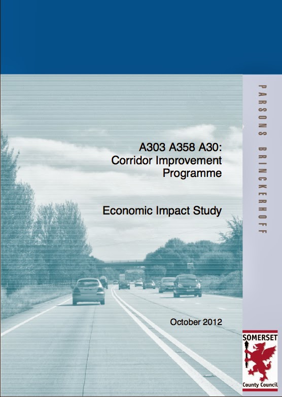
The second document, and by far and away the single most important information source we have come across, so far, is the "A303, A358, A30: Corridor Improvement Programme - Economic Impact Study" of October 2012. This most boring sounding report was produced by Parsons Brinckerhoff for Somerset County Council. What on earth has a report commissioned for Somerset County Council got to do with the little village of Winterbourne Stoke in Wiltshire, rat-running on the roads around and the problems at Stonehenge?
Well you might ask. Somerset Council are to be congratulated for an inspired piece of work. Parsons Brinckerhoff undertook an appraisal of the economic benefits of dualling the full length of the A303 between Amesbury and Honiton as well as the A358 between Ilminster and Taunton. The bottom line, for all of us, is that if the A303 and the A3588 were both dualled, then in the context of this plan as a whole, for every pound spent on providing an A303 by-pass for our village of Winterbourne Stoke, the economy would recover £1.80. For every pound spent putting the A303 in a tunnel the economy would recover £1.80. The economic advantage is astonishing. Isn't it a crying shame that Wiltshire Council hadn't either participated fully with Somerset Council and produced a joint document with breakdowns to county level or commissioned a purely Wiltshire-centric study at any point over the last 30 years?
Despite the horrific title, this report is a really good read - and we suggest everyone does at least dip into it. It is full of useful facts and figures that we can make use of in the campaigns to improve our lot. It is also very well researched and the authors have, in places demonstrated they have seen through the inadequacies of some of the Government's own data processing and interpretation. Perhaps the best example of this is when it comes to traffic volumes.
Consider the traffic statistics for our village of Winterbourne Stoke. They look fairly interesting, but one set of numbers got me thinking - those for bicycles. It seems that four times more bikes go west through our village than go east. There could be lots of reasons for this, but amongst the most likely reasons is the fact that it may simply be an aretfact of the way data was collected. Thankfully, the Department of Transport has published its methodology for Road Traffic Estimates.
More turgid stuff, but what it appears to say is that they try to do a manual count on each sampled road length, like the census point 6874 on the A303 at Winterbourne Stoke, as often as they can. In reality, this means that every 1, 2, 4 or 8 years (depends on the road), they conduct a manual survey for 12 hours. Of course, they don't work weekends, public holidays or school holidays; nor do they survey between November and February. They only undertake manual counts on the 110 what they call 'neutral days' each year. I guess that is DoT speak for saying they only work on Tuesdays, Wednesdays and Thursdays when it isn't cold - poor dears!
These infrequent manual counts are supplemented by electronic input from a national network of 180 (yes, you read that correctly 180) of Automatic Traffic Counters that are used to produce what they call "expansion factors" to interpolate the traffic flow 24 hours a day, 365 days a year; something DoT refer to as the annual average daily flow (AADF). In other words, this is pseudo-science, a wise-arse guess, or more succinctly, in the vernacular, complete and utter bollocks.
Interpolating from data derived in this way has a number of effects. Regardless of any seasonal road traffic variations, the inbuilt methodological bias will overestimate the AADF on urban roads where traffic flow is predominantly on weekdays and underestimate traffic flow on rural roads. The methodology will grossly underestimate traffic flow on the A303 and similar rural trunk routes to holiday destinations, where high traffic flows are predominantly over the weekend, bank holiday and school holiday periods when the manual data is simply not collected.
Worse is to come. Investment in roads inevitably follows the perceived usage 'statistics'. When the usage statistics are as flawed or fictitious as the AADF, the money will be used for urban roads and not rural ones. It's all down to perception management - we have to ensure the debate questions and asks for validation of every bit of data that is presented - regardless of the source.
Parsons Brinckerhoff, in undertaking the "A303, A358, A30: Corridor Improvement Programme - Economic Impact Study" appear to have looked at the DoT methodology and found it wanting. They seem to have come up with a different, possibly more robust approach to traffic flow (see section 2.2 of the above report), but it is still based on the manual and automated traffic counts. We'll be doing some more digging to see just how robust this approach really is.
We suspect that the report may still underestimate traffic flows on the A303, but the good news to end this post on, is simply this. Parsons Brinckerhoff may also have have underestimated the financial benefit to cost ratio of dualling the A303 and thus providing a bypass to Winterbourne Stoke. That is even without considering both the financial and non-financial benefits to Shrewton, Orcheston, Tilshead, Larkhill, Durrington, Berwick St James, Stapleford and all the other local villages currently suffering
Friday, 4 October 2013
Of Turnpikes and April Fools
To understand the present day A303 trunk road, you have to
understand a little bit more about the recent history of routes around
Stonehenge and the road west from London to Penzance.
The bigger road near Stonehenge didn’t initially run along the route
of what became the A344. Instead,
it led from Amesbury to Seven Barrows (Now known as the New King’s Barrows) to
Maddington, north of Shrewton, and then on to Warminster and eventually the
important trading port of Barnstaple in north Devon, via Bridgewater.
Traffic on the minor route between Amesbury and Mere, past Stonehenge and on through Winterbourne Stoke, really
picked up in the 1700s and around 250 years ago, the powers that be organised
themselves into the Amesbury Turnpike Trust, opening up the route from Mere
to Thruxton and on to London. Money raised through tolls was used to maintain these roads and provide
a profit for the turnpike trust.
It was probably around this time that the direct link to Bridgewater and
Barnstaple was broken when a section of the route was converted to parkland by
an affluent landowner – no doubt trying to recreate his idealistic view of what
the “natural” landscape should look like. Sound familiar?
Attempts were made to improve the road to Shrewton after
1761, but these were abandoned. In
1773, a brand new turnpike road was built, leading away from the Amesbury to
Mere turnpike at Stonehenge Bottom, directly to Shrewton; the route of the
recently closed A344.
In 1871, both these roads and several others in the locality
were dis-turnpiked. The reasons
for this are unclear, but by the early part of the 20th century, the
main route west from London had changed radically west of Basingstoke and looked
as follows. It began by
following the route of what was then the A30:
London
Hounslow Heath
Staines
Egham
Bagshot
Hartley Row
Basingstoke
Dummer Down
Stockbridge
Lopcombe Corner
Salisbury
Wilton
Shaftesbury
Sherborne
Yeovil
Crewkerne
Chard
Yarcombe
Honiton
Exeter.
Then along a bit of the then A38
Exeter
Kennford
Chudleigh
Ashburton
Ivybridge
Plymouth
Torpoint
Liskeard—
Bodmin
And finally back on the route of the A30
Bodmin
Fraddon
Zelah
Redruth
Hayle
Penzance
In 1936, the Trunk Roads Act came into force, intended to
develop a network of 30 fast, important and ‘modern’ routes across the UK. A bit ironic when you consider the
traffic jams of today. The route
of the current A303 through Wiltshire wasn’t even considered as part of this
review – the London to Penzance route via Salisbury was going to become the new
T3 trunk road. As it happens, the
new nomenclature, based on the French Route Nationale, was never adopted, even
though all the new signs had been prepared and so the A30 kept its status as
the main trunk route through the West Country.
In 1939, the bridge over the River Till in Winterbourne
Stoke , which now carries the A303, was built. No doubt it was designed to carry the traffic of the 1930s
on what remained a minor route to the West Country. (The Till road bridge
became a listed Grade II building on 10 October 1988). Aside from a few repairs and
modifications to the roadway over the years, the bridge remains largely
unchanged form its pre trunk road days.
This is a really important factor when considering the A303 today and it
is a point I will return to in future posts.
Nothing changed after WWII either. In 1946, a second Trunk Roads Act was passed, but again, the
London to Penzance route in Wiltshire remained unchanged.
It was only in 1958 that the A303 was born and the role of
the A30 downgraded. On April the 1st
to be exact.
Finally, in this roundup of the last 250 years of recent
history, the Amesbury bypass was opened in 1970 – ending a few hundred yards
east of Stonehenge bottom and providing us with the legacy from which we now suffer.
There is an encouraging message here, for all of us. Paths
have become tracks and tracks have reverted to downland. Downland has become road. Roads have
become turnpikes and in turn, these have been de-turnpiked. Trunk roads have been created and then
detrunked.
Nothing that has been done to the roads around Winterbourne
Stoke and Stonehenge in the past can’t be undone in the future – it has
happened time and time again before.
When it comes to the A303, there is no such word as can’t.
Wednesday, 2 October 2013
The Old Way is Often the Best - Or: How English Heritage and Others Have Abused Our Heritage
Anyone wishing to enter the debate on the A303 and the traffic
problems a single-carriageway road generates around Stonehenge – recently
worsened by the closure of the A344 at the behest of English Heritage - should have at least a little
understanding of the history of the A303 and the surrounding tracks and paths.
Ok, let’s begin with ancient history and few statements of
the blindingly obvious. These are
needed to understand the nonsense of English Heritage’s desire to return
Stonehenge to its ancient setting.
At some point in time, and no one knows when for sure, ancient man
wandered past the area of what eventually became the site of Stonehenge. Over time, many more people,
individuals, family groups, tribes wandered past the same area. They may have wandered randomly across
the ancient landscape, but people don’t tend to move around in that way; they
find the easiest and safest routes, the routes that take them to water, food
and shelter and they also move towards sites that mean something to them. For instance, they wandered westwards in Neolithic times, crossing the River Till and later building a wooden bridge whose remains were found recently in Winterbourne Stoke. The more people who travelled that way,
the more these paths became permanent features of the landscape. Most importantly of all, of
course, the scale of the paths and
tracks both matched, and was a reflection of the transport needs of
pre-Stonehenge southern England.
Once someone had the bright idea of building a wooden prototype (probably during the Mesolithic period (8500 to 7000 BC)) for what would eventually become a glorified
rockery in the middle of Wiltshire, paths, tracks and even fairly wide roadways would have
been apparent across Salisbury Plain – leading right up to the site of Stonehenge. Paths pre-dated that pre-dated every phase of the henge. Routes would have been adapted and
adopted to meet the transport needs of the day. It seems likely that later still, when Stonehenge came into use, paths
and tracks would continue to evolve to meet changing needs.


One of these routes already was, or became, a major East-West
route; later known variously as the Old Way, the Harrow Way (Harroway) and even
the Hoary Way. It would have been
used as a means of travelling east-west for trading, to move armies rapidly (a Herewag or Herepath) or
as a route to, or past, a sacred place (Stonehenge?) and again the routes
around the stones would have been altered to meet the changing volume of human traffic
and other emerging traffic needs.


Around 1930, the A344 seems to have been the dominant road, at least judging by this old photo of a car deciding whether to fork left towards Exeter or continue right, past the AA Box, towards the Stonehenge Cafe:

Judging by the road positioning, the driver is either indecisive or a foreign visitor. This priority probably continued until the Trunk Road Act of 1936.
This evolution of traffic and routes to meet current transport
requirements carried on for thousands of years, until 2013, when, at the behest
of English Heritage the A344 – A303 link was closed in June 2013.
Call me a cynic if you will, but isn’t it ironic, that the
body charged with protecting our heritage has itself buggered up so much of it around Stonehenge?
They clearly seem to want to bugger up yet more of it by closing other
tracks and by-ways in the vicinity of the stones, without any historical
imperative for doing so.
If English Heritage had any integrity at all, returning
Stonehenge to the ancient landscape they claim to want would be a very
different prospect to the Disney-fied future they seem to have planned. They and other agencies
involved should honour the evolutionary nature of our English heritage by
re-opening the A344, create a dual carriageway to relieve the beleaguered village of Winterbourne Stoke, move the path of the A303 away from the stones, or bury it alongside them, dualling that section as well, all to meet the very obvious transport and economic demands.
If they refuse and obfuscate, as seems inevitable? Well, you have to
consider how the A344 and the A303 got there in the first place? They arose by force of public opinion
and use – not through public inquiry, planning consent and parliamentary
pontification. One thing I am sure
English Heritage would not disagree about – and that is we should always learn
the lessons of history and act upon them.
The Need for Evidence-based Decisions on the A303 - Not the Usual Nonsense
Here at WiSBAng we are firm believers in evidence-based government
policy, not the usual emotional knee-jerk, ill-educated, gut-feeling, wishy-washy,
party politics-driven claptrap to which we are usually subject and which has
been the bane of the debate around the future of the A303 and the much needed bypass for Winterbourne Stoke.

One of the roles of this blog, aside from the occasional
rant, is to dig out that evidence and try and put as much of it as possible
into one place. That gives you,
the reader, an easy way of getting to it and deciding for yourselves the merits
of any particular line of argument.
Make up your own minds – chase the evidence.
Clearly, we don’t have the resources or time to find all the
interesting, useful or downright embarrassing evidence ourselves, so if we miss
anything, let us know by leaving a comment to a blog post.
Subscribe to:
Posts (Atom)