Showing posts with label Freedom of Information Act. Show all posts

Wednesday, 1 October 2014

Stonehenge: A Few Scary Moments On The A303 At Stonehenge Bottom

Earlier today, I went for a bike ride to clear my head and for the last part, I rode north-eastwards along Byway 12, to the A303.  Crossing the A303 is never easy and you need to have your wits about you.  Putting it bluntly, when you cross the A303 here, you have to remember that the great travelling public aren't really thinking that they might encounter people by the roadside.  Why on earth would there be people close to one of the wonders of the World; I ask you?

As a consequence of this, anyone attempting to cross the A303 at Byway 12, Byway 11 or Stonehenge Bottom has to regard themselves as a slice of ham about to be sandwiched between two pieces of steel-reinforced "bread" with a closing speed in excess of 120 mph.  Get it wrong and it is going to hurt - briefly, bloodily and almost certainly, finally.

At Byway 12, you have to wait until you can't see vehicles in either direction to have enough time to stroll, not run, across the A303.  Running isn't advised, as if you were to fall, you simply wouldn't have time to pick yourself up before the Grim Sandwich Maker appeared.  On quiet days, you might have to wait a couple of minutes for a safe gap - there aren't many quiet days any more!  On a bad day, you might have to wait 10-15 minutes or even longer to cross in reasonable safety, or simply give it up as a bad job and back track. Too many lose patience and take silly risks...

Today wasn't too bad and I was safely across in under a minute.  I rode up to the A344 then onto the temporary permissive path between Byway 12 and Stonehenge Bottom.  As I crested the ridge down to Stonehenge Bottom I was confronted by a veritable gaggle of cyclists heading down towards the A303.


They were a nice friendly bunch and I explained that I was part of STAG and what we were about and please could I take photos of them if they were trying to cross.  They were happy for me to do so, so here is a short vignette of what happened next.

The thought of them all trying to cross made my blood run a bit cold as the traffic here is gravity-assisted in both directions and the westbound traffic is still trying to settle scores with other drivers from the 2 lanes into 1 section of the A303, a few hundred meters to the east.

A few cyclists at the front of the group spotted a small gap and either ran or rode across.

Most of them didn't get the opportunity and there was  steady stream of fast-moving traffic in both directions on what is, at this point a Clearway, not that anyone gives a tuppeny-damn about the Highway Code these days!

They waited, and waited, and waited.
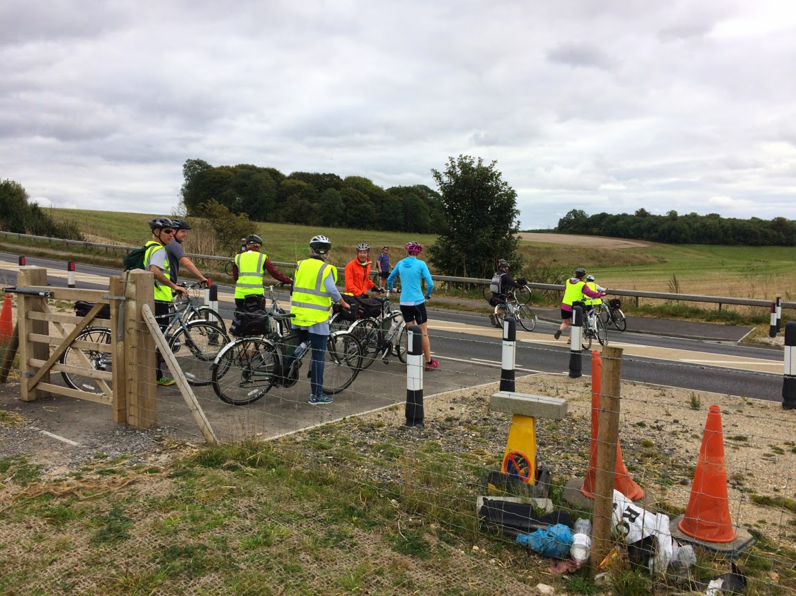
When a westbound gap appeared they moved forward, then back again as it disappeared.

One of them made it to the central strip and an eastbound driver in a grey car slowed and stopped.  Remember, it is a Clearway - no stopping.

The cyclists, not quite sure what to do now, all started to move off the verge towards the centre of the A303,  but did so very hesitantly.  The westbound traffic was still thundering past them with mere inches to spare.  It couldn't have been a very pleasant experience.

White van man from Black Hole Storage Removals clearly didn't give a damn and went roaring through and this carried on for a while until another grey car stopped on the westbound carriageway.
and finally, the whole group got across safely.

It could so easily have been very different.  But why are things so dangerous?

Well, the people who control the World Heritage Site have a policy of making Stonehenge a more bike (and horse and pedestrian) friendly place.  This seemed to be borne-out in the plans for the new visitor's centre submitted by English Heritage.  However, despite their intentions and despite planning conditions that mandated a whole raft of measures that would have improved things for cyclists, English Heritage have singularly failed to deliver.

One of the few things that was largely outside the control of English Heritage was an improved crossing at Stonehenge Bottom.  On the one hand,  increased usage of the crossing point was anticipated by all parties after the closure of the A344, hence the planning requiremnt.  However, a spoke was put in the works by the Highways Agency who produced a report - in the way Government Agencies do when they don't want to take action.  The conclusion of this report reads as follows:


"It is the designer’s view that the current usage of this crossing by pedestrians or by cyclists, on either the A303 or the A344 routes, does not justify the increased risk to motorised users on the A303 of providing refuge islands for this crossing. However it is felt that the opportunity to relocate the crossing to the best location position for NMU visibility and to reduce the crossing width is justified and should be taken.

In taking this view, the designer is taking note of RSA team preference, based on pedestrian rather than cycle use of the crossing, of the do minimum crossing type. The designer is also influenced by the fact that this is far from being the only single carriageway rural at grade crossing of the A303 with no specific NMU facilities, including equestrian crossings. 

The proximity of this crossing to the Stonehenge World Heritage site does not currently attract to it significant NMU usage. It is therefore felt that neither the existing usage of the crossing or the last five year’s accident records warrant a different approach here to that taken at other similar crossing locations where the balance of risks between NMU and Motorised Users, and hence the actual overall risk, dictates the level of provision made. 

It is therefore recommended that the measures in Option 4 proposals, with the refuge islands removed but all the other measures retained is adopted. 

A future scheme for reviewing the crossing arrangements needs to be submitted and approved. The scheme shall have regard to Design Manual for Roads and Bridges HD 19/03 Stage 4 Safety Audit 12 and 36 month post scheme recommendations for any remedial action. 

It is felt that the extensive investigation already under taken into the examination of the safety of and the changes to the crossing here proposed satisfies the requirements of the planning condition."

Just for the record, NMUs are non-motorised units - pedestrians, cyclists and horse riders.  Cutting out all the crap, what they are actually saying is that the body-count at Stonehenge Bottom is too low to warrant making anything more than superficial changes. However, they go on to suggest that a safety audit at 12 and 36 months might change things if the body count increases.

I don't suppose the contribution by Wiltshire Council helped much either:


"...that in relation to cycle usage their preferred route between the A344 to the north and Amesbury for cyclists was via the countess roundabout underpass crossing of the A303 and than via Lark Hill."  (all the typos and grammatical errors are courtesy of the Highways Agency!)

As usual with Wiltshire Council when it comes to anything in the south of the county - thumbs up bums and brains in neutral all the way.  No-one in their right minds, who knew about the local area, would ever choose to get from the centre of Amesbury to Stonehenge by heading north, through the scrofulous Countess Roundabout underpass (on foot - as cycling is forbidden on this bit of the cycle route), up Countess Road, being harassed by rat-running motorists, then head west to Larkhill along the rat-run of choice for coaches and HGVs, before eventually getting to the northern end of Byway 12.

Most sensible folk will simply head out to West Amesbury, up to the A303 and then to Stonehenge Bottom and the A344 - no need to ride with high speed traffic at all - just dice with death crossing the A303.  That's what they've always done, that's what they were doing today and that's what they will do until the A303 issue is resolved once and for all. 

Of course,  there was a fall-back plan to monitor the situation.  Here it is.  Read it carefully and spot the flaw:


STONEHENGE ENVIRONMENTAL IMPROVEMENTS PROJECT Planning Application Reference S/2009/1527 

Scheme required under planning condition 27 for reviewing pedestrian and cycle route access arrangements along the whole of the A344, and crossing arrangements at the A303 (Stonehenge Bottom)

Following approval of the details of the pedestrian and cycle route access arrangements along the whole of the A344 and crossing arrangements at the A303 (Stonehenge Bottom), English Heritage will co-operate with the Local Highways Authority, Highways Agency and the Local Planning Authority in reviewing the arrangements. In particular, should a formal Stage 4 Safety Audit be carried out, and any recommendations for remedial action be made in the 12 and 36 month Stage 4 Reports submitted to English Heritage and the other organisations, then any required remedial works, and arrangements for their implementation and funding, will be considered and agreed between English Heritage, the Local Highways Authority, the Local Planning Authority and the Highways Agency, as appropriate. 

In addition, English Heritage will carry out the following:

  • -  Incorporate questions about the pedestrian and cycle access into the annual visitor survey conducted by the travel and tourism department of market research company TNS. This will comprise face to face interviews with 180 individuals during the months of July, August and September. Likely questions include: whether people have accessed the site on foot or on bicycle, and, if so, where they have travelled from, how satisfactory they have found the route and where they are travelling onto. 

  • -  As part of the ongoing operational management of the site English Heritage staff will, as a matter of course, record, report to the relevant authorities and, if appropriate, take any necessary action in respect of any incidents or accidents along the route of the A344 between Airman's Corner and Stonehenge Bottom. 

    English Heritage 26th April 2012
 
Did you spot it?  Yes, that's right.  Most pedestrians, cyclists and horse riders arriving at Stonehenge don't pitch up at the visitor's centre, as there is (still) no provision for them.  They may arrive from east or west, north or south, but we suspect that few, if any, will be invited to take part in the annual visitor survey, conducted for English Heritage by TNS.  
During my many visits to the WHS this July August and September I've never seen anyone with a clipboard interviewing pedestrians, cyclists and the two riders I have seen, nor have I ever been approached.  Now that's interesting, if true because this safety audit is meant to be looking at the safety of crossing the A303 by any and all users, not just English Heritage's paying customers.
As I say, we don't know for certain that this is the case, but I feel an FOIA request ,or two, coming on! 


Thursday, 23 January 2014

English Heritage: Give Them An Inch And They Take a Mile

You never quite know what is going to arrive in the post.  Usually, it's just bills and the usual advertising rubbish that is of no interest and only serves to kill off a few more trees.  Sometimes though, it can be a real pleasure.  Today was one of those days.

I got a letter from a lovely chap, a long time opponent of the A344 closure and proponent of dualing the A303, who goes by the name of "Vexatious Alan".  The epithet isn't because he really is vexatious - it's a bit of a badge of honour in Freedom of Information Act circles that he has got so far up some august body's nose, probably because he was close to exposing some sort of misdoing, they have decreed his FOIA requests are "vexatious" and so they don't need to answer them!


 Receiving the letter was a real pleasure as I so rarely get them - letters written by real living and breathing human beings that is.  I normally operate in cyberspace, grabbing information here there and everywhere - cutting and pasting it into new documents and blasting them back out into the ether.  Having to deal with a typewritten letter was something of a novelty...

...anyway, let's cut to the chase and look at the information "Vexatious Alan" provided.  Since November 2010 he has been pursuing English Heritage in relation to pedestrian and cycle access along the route of what has now become the former A344.  Back on the 24th November 2010, Loraine Knowles of English Heritage wrote to "Vexatious Alan" to explain the rationale behind the Stopping Up Order for the section of the A344 from Stonehenge Bottom on the A303 and the intersection of the A344 with Wiltshire Byway 12.   Loraine Knowles wrote the following on behalf of English Heritage:


"...there was a firm consensus that a stopping up order was more appropriate... 
...in view of the clear intention to return the surface to grass. However, the need to provide access for non-motorised traffic had been recognised at that time, and for this reason it had been proposed that a permissive route be provided for pedestrians and cyclists between Stonehenge Bottom and Byway 12."

"We would note that the commitment to provide a permissive route between Stonehenge Bottom and Byway 12 is a requirement of the Section 106 legal agreement signed by the National Trust, DCMS, EH and Wiltshire Council."

Now that is both interesting and puzzling.  I'm not a legal eagle but common sense dictates that if the right to drive a motorised vehicle along a stretch of road are removed through the implementation of a stopping up order and a TRO, as were used in the case of the A344, then the right to move along that route on foot, on a bike or on a horse still exist as they weren't specifically removed.  So, in one sense, I don't see why a permissive byway was needed as a de-facto substantive byway already existed along the route and continues to exist.  But, until someone comes along and can provide the legal view on all this, let's play the English Heritage game for the moment - they have a legal obligation to provide a permissive route between Stonehenge Bottom and Byway 12.


Wiltshire Council in the planning consent for the recently opened visitor's centre imposed a series of conditions that English Heritage were obliged to sign-up to.  According to the information provided to me by Vexatious Alan, the last of these, Condition 27 reads as follows:

"No development shall commence until

         (i)  details of the pedestrian and cycle route along the whole of the A344, including the crossing
               arrangements at the A303 (Stonehenge Bottom) and

        (ii)  a scheme for reviewing such access and crossing arrangements

have been submitted and approved (in consultation with the Highways Agency) in writing by the local planning authority".

"The development shall not be occupied until the agreed works have been completed".

"The scheme for reviewing the access and crossing arrangements...

...shall detail how recommended remedial action will be funded and implemented, including arrangements to provide for alternative crossing points on the A303 and associated access links."


Wiltshire Council recently provided "Vexatious Alan" with a map of what the A303 junction and paths at Stonehenge Bottom should have looked like, before the new visitor's centre was allowed to open.  You WILL need to click on this to see it.


"Vexatious Alan" has helpfully highlighted the length of new path that English Heritage were supposed to install and a pre-existing path that English Heritage seem to have removed.

Anyone who has tried to cross the A303, use the new gate and ride a bike up to Byway 12 knows that English Heritage have not done what they were supposed to do.

UPDATE:  Having read the original version of this post, an up-to-the-minute STAG member sent me a photo, taken only yesterday, looking back down the stopped up A344.  Note the high quality footpath and cycle path - NOT!  Interesting to see that the byway - permissive or substantive - with its steel fencing across it, gives the impression of not being a byway at all!  Anyone would think that English Heritage were trying to convince people it didn't exist and deter them from trying. 


I think that both English Heritage and Wiltshire Council Planning Department have a few questions that they need to answer pretty sharpish and as a matter of public interest.  This isn't only important in the context of the A344, but also of considerable importance when it comes to what might happen with the A303 after the planned feasibility study reports.

It seems, if the information above is to be believed and I have no reason to doubt it, that English Heritage cannot be trusted to comply with legal agreements it has willingly signed up to and legal conditions to which it is subject by virtue of the planning process.  Furthermore, Wiltshire Council seem to have failed to monitor compliance with the Conditions of the planning consent that THEY imposed.

None of this fills me with a sense that either organisation is to be trusted.  With English Heritage it really does seem to be a case that if you give them an inch, they will take a mile. It actually makes me feel somewhat...


Friday, 25 October 2013

The Fiction of the Traffic Census - According to the Highways Agency

In an earlier post, we explained how the Department for Transport has a methodology for working out what they call the annual average daily flow (AADF).  They seem to rely on a manual traffic census conducted every 2, 4, 6 or 8 years and supplement this with data from Automatic Traffic Counters.

You should read that original article, because it explains why, even if the methodology is used, it is inappropriate for a road like the A303. Anyway, onwards.

We thought it might be helpful, in understanding the traffic flows on the A303, to have an idea of how often manual censuses actually take place, as that says quite a lot about how up-to-date the data being used in the forthcoming reviews might be.  So, we fired off an FOIA to the Department for Transport and back came an answer from my new chums at the Highways Agency - charged with managing England's motorways and strategic A-roads on behalf of the DfT - or should that be mismanaging them?


We asked for the details of any traffic censuses on the stretch of the A303 through Winterbourne Stoke since January 2000; very unambiguous and straightforward.

 The reply we got, as with previous FOIA responses from the Highways Agency, took as by surprise.  It was the one answer we were definitely not anticipating: "We are unaware of any traffic censuses for the A303"

Wow, not just no traffic censuses on our little bit of the A303 since 2000, but none on any of its 90 mile length during that time period.  So, decisions on dualling (or not!) the A303, the closure of the A344, the drawing up of Somerset Council's study on the A303, A358 and A30 have all been based on figures that were not based on manual census data which lies at the heart of the DfT  Road Traffic Estimates Methodology.  At least that is what DfT claim to do - but seemingly not when it comes to the A303.

Frankly, I think that is pretty disgraceful.  I'm sure the HA will protest that they can get all the information they need from the automatic traffic counters (ATC's), but DfTmake it quite clear that the ACTs c.an only collect some of the data recorded in manual censuses that are used to classify vehicle types.  The types of traffic are important when considering the A303 and the ACTs.  When a manual count is carried out, 6 different classifications of HGV are recognised (3 rigid and 3 articulated).  ACTs only recognise HGVs as being rigid or articulated - so they couldn't tell, for instance, the difference between a rigid HGV with two axles and a rigid HGV with four axles.

Which, if DfT/HA are to be believed, makes me wonder how they have come up with traffic statistics like these (click to see enlarged view):


Clearly, these are the manual census categories - yet no manual censuses have been carried out according to HA.  Interpolation by witchcraft perhaps?  Once again, it seems that the Highways Agency:

A. Couldn't tell their arses from the their elbows - even with the benefit of a map.

B. Are inefficient, ineffectual and can't find their own data.

C. Are being disingenuous.

We have asked for clarification.

We also think the Department for Transport should do a bit of re-branding of the Highways Agency with respect to the A303 - we think this would be a tad more honest:


Tuesday, 22 October 2013

When Is a Road Not a (Rural) Road?

When is a road not a rural road?  Quite simply, when the Highways Agency (HA) have anything to do with it and it suits them.

We mentioned in a previous post that we'd put in a Freedom of Information Act request using the What do They Know website to ask the Highways Agency a fairly simple question - how wide was the A303 as it passed through our village of Winterbourne Stoke.


The reason we asked the question was that at certain points within the village, the A303 looks and feels much narrower than on other parts of the single-carriageway stretches of the road between Beacon Hill and Honiton.   We suspected the reason for the narrowness of the A303 in Winterbourne Stoke was the bridge over the River Till, a Grade II listed structure, built in 1939 and pre-dating the creation of the A303 trunk road in 1958.

We'd already made a few measurements of the road ourselves - on the premise of never ask an FOIA unless you already have, or strongly suspect you have, the answer.  So whilst we hoped we might get some genuine data, we half-expected we might get a less than satisfactory response - and so it turned out.


Click on the picture to see an enlarged view.  Basically, the HA claimed that the A303 is shown in their HAPMS database to be 7.3 metres wide at 20 sites on a 1 mile stretch of the A303 as it runs through the village.  This, according to our own measurements, was clearly complete and utter nonsense and it looked as if the HA had simply recorded the minimum desirable width of a an A road as the actual width of the A303.  An honest mistake, dodgy instrumentation, incompetence or worse?  Well that is for others to establish, but we couldn't let it rest and went back to the HA for further clarification and to point out what we thought was a problem with the data. 

The reason that this is so important is that public inquiries, reviews and other studies, rely on the HA to produce accurate data on roads to enable those inquiries to come to informed decisions as to how poor roads might be and how essential it might be to upgrade them.  Given incorrect data, they might be led to the wrong decisions.  This might have already happened in the past and might happen again in the forthcoming review of the A303.

Yesterday, we received a follow-up answer from the HA and I had to confess that my jaw hit the floor when I saw, shortly before I burst into bouts of uncontrollable laughter.  Strangely, others who saw the letter had a similar reaction, making comments such as:

"What (expletive deleted) planet are they on?"

"Does the HA provide LSD for its staff?"

"Have they ever been on the A303?"

What could possibly have provoked such a reaction?


Well, how about the HA statement that the "A303 through Winterbourne Stoke is most suitably referred to as an Urban setting".  

I am not quite sure how the HA 'expert' arrived at this conclusion, nor does he explain, but we would have thought that the definition of urban is very clear - it relates to a town or city - not a small village with under 80 dwellings set in a rural parish, in a rural ward of a rural county. 

However, to make life very straightforward for the HA and to avoid any possible confusion, we have pointed out that there is an HMG definition of rural and urban.  Both the HA and the Department for Transport use this definition in their publications - so you might expect that it would be used in defining whether a road is urban or rural.  The UK government define "urban" as outlined below:

"As a standard for general purposes a threshold population of 10,000 is recommended, with
all settlements of over 10,000 treated as urban areas and smaller settlements, together
with all other land, treated as rural".


So, a road in an urban setting would be one that ran through a population centre with a population of 10,000 or more.   Hmm, Winterbourne Stoke has just over 200 - hardly an urban setting then.  Unless, of course, the HA are counting the people stuck in traffic jams in Winterbourne Stoke as being part of the permanent resident population - well I suppose it does sometimes feel a bit like that.

We've gone back to the HA to ask them to try again and to point out to their expert the difference between rural and urban settings.   We've also asked them to clarify where, in their alternate reality, to the east and west of Winterbourne Stoke, does the urban setting of the A303 turn into a rural setting.

This set us thinking a bit.  If HA are right and we really are an urban setting, then it is government policy to have speeds of no more than 30 mph through the village because of the houses alongside the road. They would prefer the speed limit should be reduced to 20mph because of the number of properties with entrances onto the A303 in the village (>20- try counting, you'll probably have more than enough time)  - along with suitable traffic calming measures - road humps, chicanes, planters, etc.  So HA - if you are correct, remove the 40mph sign and lower the speed limit to meet government policy recommendations.  Whilst you may not be able to enforce the speed limit, the traffic calming measures would ensure a 24/7 traffic jam that would achieve the effect for you.

Of course, if Winterbourne Stoke is a rural setting, as we strongly suspect it might be, then the A303 is structurally too narrow to be a rural, all-purpose, mainline road road and that gives the HA a bit of a head-ache.  What are they going to do?   By rights, you'd think they should de-trunk the road. 

What is abundantly clear is that the HA can't be allowed have it both ways - and perhaps they should draw the attention of Ministers to their past mistakes to avoid repetition in the coming months.

Finally, you'll note in the HA's second response that the author accepts our road measurement without question.  Not only does the author accept it, he re-states it as a matter of fact.  A suspicious person might conclude, on the basis of this, that the HA's first answer to us was intended to deceive.  Now why might that be?


Tuesday, 15 October 2013

Are English Heritage Being Economical with the Truth, Being Unhelpful or Simply Being Ineffectual?

We've just had a response to an FOIA from the Historic Buildings and Monuments Commission for England - otherwise known as English Heritage.  We'd used the What Do They Know Site for simplicity and also to enable others to search both the question and the response.


We had asked a fairly straightforward question and that was, how many vehicles have been using the Stonehenge car parks over the last few years.   Clearly, in planning car-park sizes and access requirements for the new visitor's centre, you would have though English Heritage might have had to come up with a few facts and figures to support their planning application,  facts and figures that would be required by the relevant planning authorities, facts and figures that could be checked and validated.

Well, you might think they would have such facts and figures, but apparently not.  Their answer to the FOIA was:

"Having considered your request I can confirm that English Heritage does not hold the information that you have asked for."

That took us by surprise.   If English Heritage really don't have such information, then the car-park for the new visitor's centre had been built without any evidence to support its size, cost and location - which raises lots of questions about competence, damage to virgin countryside, etc etc.   It raises similar concerns about the relevant planning authorities.

Alternatively, English Heritage may be being deliberately obstructive or economical with the truth.  We had asked for a breakdown of data on the basis of vehicle type, as used by the Department for Transport, on the assumption that English Heritage (an executive Non-Departmental Public Body sponsored by the Department for Culture, Media and Sport) might be expected to collect data to a common standard with government departments and other public bodies.  Perhaps they don't and collect data in some other form which doesn't directly equate to such common standards - in an ineffectual sort of way.

If they were collecting any sort of traffic data for the Stonhenge site, you might have expected them to volunteer that fact if the question was clearly intended to elicit such information - but they haven't done that.  So if they have any relevant data, they are being unhelpful and disingenuous.  Similarly, if they have used or had access to such data prepared by others, you would expect them to indicate who that might be.

Of course, there may be other explanations and so, before pointing fingers, we have requested an internal review of the answer - as we are prepared to be charitable and accept that English Heritage are merely being ineffectual for the moment.

However, until such clarification is forthcoming, we have to accept English Heritage's own explanation that they "do not hold the information that you have asked for", meaning the new visitor's centre at Stonehenge has been built without any idea of the vehicular traffic likely to use it; suggesting that English Heritage have ridden roughshod through the planning process.  It makes you wonder if a similar lack of stratification of traffic using the A344 was used to defend the decision to close it at the behest of English Heritage?

UPDATE:

A very swift response from Historic Buildings and Monuments Commission for England

"Having read your most recent email you would appear to asking for different information to that which you did initially: your most recent request focuses on the general use of the car park at Stonehenge while the latter was concerned with the use of the car park by specific types of vehicles.

Given the above I do not think that an internal review is appropriate. Instead your most recent query l will be treated as a new request."


I have to say it smacks of unhelpful games being played...


...I think there was a lack of candour in the original answer.


Saturday, 5 October 2013

Good Information is Essential to Make Our Case

One of the difficulties in pressing forward the argument for a bypass for Winterbourne Stoke and Stonehenge is that we need good information to inform our position and to rebut the arguments of the opposition.  Often, the information we need is deeply buried and seemingly inaccessible and is often under the control of the very people and organisations who are proving a stumbling block.

Part of the mission of this blog is to wheedle out that information, provide easy links to it so that you can read it for yourselves, but also to consider whether the data that is being used is valid.  Just because information comes from an official source doesn't mean it is credible, doesn't mean it makes the case that is claimed and sometimes it has been  (let's be charitable here) mis-interpreted by the opposition.  It is for you to make up your own minds whether that misinterpretation is accidental or wilful.

Links to this information will appear both in the text of related blog posts, but also under the "Favourite A303 Links" section to the right of the blog posts.   Although the blog has an easy search facility, we wanted all the useful stuff in one place to save time.


Of course, not all of the information from official sources is readily available.  However, we can make use of the Freedom of Information Act (FOIA) to try and get at much of that.  It is very easy to do and essentially means you just write to the official body you think controls the information and ask them for it.  In simple terms, if the information you have asked for is not exempt from the FOIA (eg it's a national security issue), it isn't going to cost too much and take too long to answer it (disproportionate cost to the public interest value) and isn't covered by any other statutory "get out" clauses, then the information owner is legally obliged to provide the answer within a very short space of time.  If they don't, the whole issue can be escalated to the Information Commissioner for review.  The good news is that much of the information these days is held in searchable, electronic databases (and more historical data is digitised daily), so rejecting an FOIA on the grounds of cost is becoming increasingly indefensible.  The best FOIA questions are those where you may already know, or strongly suspect, what the answer is, but want original documents or hard facts and figures to reference in making your case. 


The whole FOIA process is made so much easier if you use the What Do They Know? website.   This is a smashing resource that gives you advice on how best to formulate an FOIA request, sends it off to the appropriate authority on your behalf, tracks progress and warns you if the recipient is failing to respond in time.  It provides an easy way of commenting on a response and then asking supplementary questions.  However, the biggest advantage is that the whole process is public.  If you make an FOIA request on your own, only you get the answer, it isn't public, isn't searchable and so isn't as useful to others.

In a campaign like this one, getting the information into the public domain is vital; so if you are tempted to make an FOIA request, please use What Do They Know.

So, what information is there already.  Well, there are already links to the Trunk Road Act (1936) and the later amendment to it, the Trunk Road Act (1946).   All good historical scene setting on trunk roads.  If you like the minutiae of Acts of Parliament, they may be of interest to you.


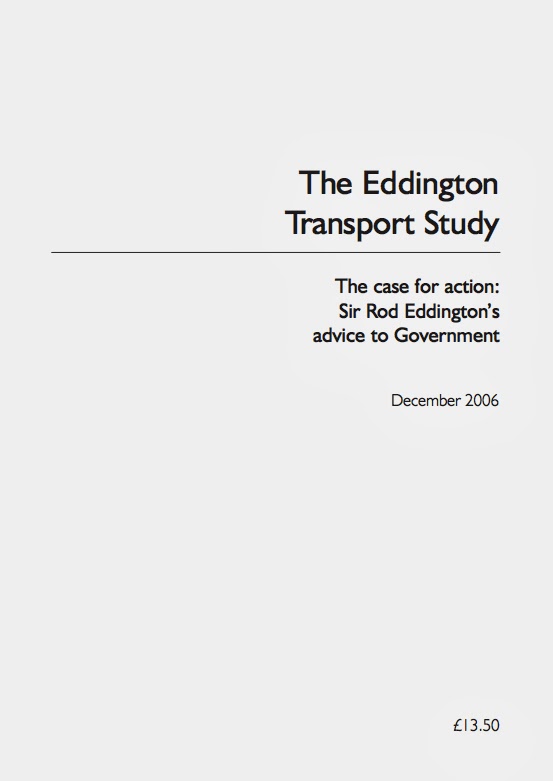
There are two excellent recent documents that everyone involved in this campaign should read and refer to.  The first is "The Eddington Transport Study" of December 2006 - written for the British Government by the Australian former CEO of BA, Sir Rod Eddington

The Eddington Transport Study set out the case for action to improve road and rail networks, as a "crucial enabler of sustained productivity and competitiveness". The report's main conclusions were that Britain has transport networks that provide the right connections, in the right places, to support the journeys that matter to economic performance. But roads in particular were in serious danger of becoming so congested, the economy would suffer.  Something most of us would agree with.


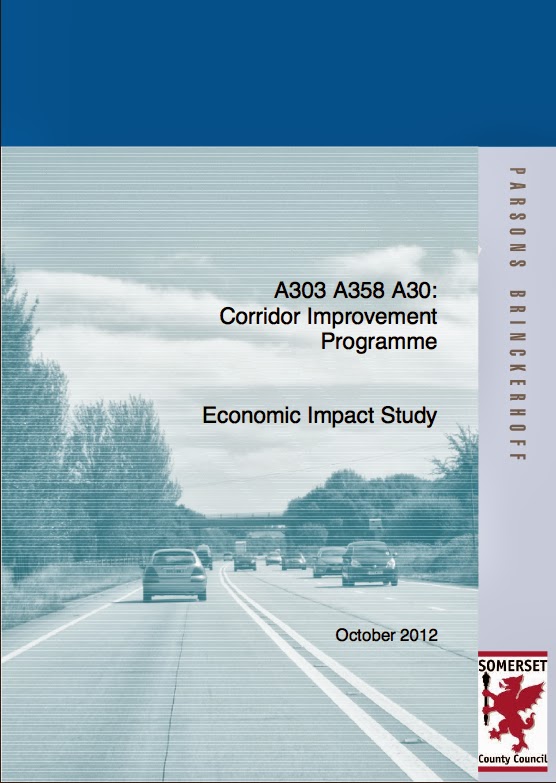
The second document, and by far and away the single most important information source we have come across, so far, is the "A303, A358, A30: Corridor Improvement Programme - Economic Impact Study" of October 2012.  This most boring sounding report was produced by Parsons Brinckerhoff for Somerset County Council.   What on earth has a report commissioned for Somerset County Council got to do with the little village of Winterbourne Stoke in Wiltshire, rat-running on the roads around and the problems at Stonehenge?

Well you might ask.  Somerset Council are to be congratulated for an inspired piece of work. Parsons Brinckerhoff undertook an appraisal of the economic benefits of dualling the full length of the A303 between Amesbury and Honiton as well as the A358 between Ilminster and Taunton.  The bottom line, for all of us, is that if the A303 and the A3588 were both dualled, then in the context of this plan as a whole, for every pound spent on providing an A303 by-pass for our village of Winterbourne Stoke, the economy would recover £1.80.  For every pound spent putting the A303 in a tunnel the economy would recover £1.80.   The economic advantage is astonishing.  Isn't it a crying shame that Wiltshire Council hadn't either participated fully with Somerset Council and produced a joint document with breakdowns to county level or commissioned a purely Wiltshire-centric study at any point over the last 30 years?

Despite the horrific title, this report is a really good read - and we suggest everyone does at least dip into it. It is full of useful facts and figures that we can make use of in the campaigns to improve our lot.   It is also very well researched and the authors have, in places demonstrated they have seen through the inadequacies of some of the Government's own data processing and interpretation.  Perhaps the best example of this is when it comes to traffic volumes.

Consider the traffic statistics for our village of Winterbourne Stoke.  They look fairly interesting, but one set of numbers got me thinking - those for bicycles.  It seems that four times more bikes go west through our village than go east.  There could be lots of reasons for this, but amongst the most likely reasons is the fact that it may simply be an aretfact of the way data was collected.   Thankfully, the Department of Transport has published its methodology for Road Traffic Estimates.

More turgid stuff, but what it appears to say is that they try to do a manual count on each sampled road length, like the census point 6874 on the A303 at Winterbourne Stoke, as often as they can.  In reality, this means that every 1, 2, 4 or 8 years (depends on the road), they conduct a manual survey for 12 hours.  Of course, they don't work weekends, public holidays or school holidays; nor do they survey between November and February.  They only undertake manual counts on the 110 what they call 'neutral days' each year.  I guess that is DoT speak for saying they only work on Tuesdays, Wednesdays and Thursdays when it isn't cold - poor dears!

These infrequent manual counts are supplemented by electronic input from a national network of 180 (yes, you read that correctly 180) of Automatic Traffic Counters that are used to produce what they call "expansion factors" to interpolate the traffic flow 24 hours a day, 365 days a year; something DoT refer to as the annual average daily flow (AADF).  In other words, this is pseudo-science, a wise-arse guess, or more succinctly, in the vernacular, complete and utter bollocks.

Interpolating from data derived in this way has a number of effects.  Regardless of any seasonal road traffic variations, the inbuilt methodological bias will overestimate the AADF on urban roads where traffic flow is predominantly on weekdays and underestimate traffic flow on rural roads.  The methodology will grossly underestimate traffic flow on the A303 and similar rural trunk routes to holiday destinations, where high traffic flows are predominantly over the weekend, bank holiday and school holiday periods when the manual data is simply not collected.

Worse is to come.  Investment in roads inevitably follows the perceived usage 'statistics'.  When the  usage statistics are as flawed or fictitious as the AADF, the money will be used for urban roads and not rural ones.  It's all down to perception management - we have to ensure the debate questions and asks for validation of every bit of data that is presented - regardless of the source.


Parsons Brinckerhoff, in undertaking the "A303, A358, A30: Corridor Improvement Programme - Economic Impact Study" appear to have looked at the DoT methodology and found it wanting.  They seem to have come up with a different, possibly more robust approach to traffic flow (see section 2.2 of the above report), but it is still based on the manual and automated traffic counts.  We'll be doing some more digging to see just how robust this approach really is.

We suspect that the report may still underestimate traffic flows on the A303, but the good news to end this post on, is simply this. Parsons Brinckerhoff may also have have underestimated the financial benefit to cost ratio of dualling the A303 and thus providing a bypass to Winterbourne Stoke.  That is even without considering both the financial and non-financial benefits to Shrewton, Orcheston, Tilshead, Larkhill, Durrington, Berwick St James, Stapleford and all the other local villages currently suffering